Earth surface shapes test
Distance learning students were asked to do homework and take tests on the diary ru website. Not only did the site crash due to such a sudden influx of visitors and showed no signs of life at all in the first 24 hours, but it also contains questions that cannot always be clearly understood. Therefore, there is a need to post the correct answers to this and other tests, so that students who are faced with the difficulties of quarantine at least do not bang their heads against the wall of bureaucratic insanity.
Mountain ranges of Russia
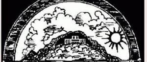
Mountains are special large landforms. As a rule, they represent an isolated, relatively sharp elevation on the surface with distinct slopes, foot and top. There are dome-shaped, peak-shaped, plateau-shaped and other mountains.
In Russia there are:
- Ural mountains. Located between the Asian and European parts of the state. This is the oldest and most extensive mountain system in Russia. However, the Ural Mountains are low and are gradually being destroyed. Their height is about 400 m, and the highest point is Mount Narodnaya (1895 m).
- Greater Caucasus. A fairly young ridge located in the south of Russia. The Greater Caucasus mountain range acts as a natural feature (border) between Azerbaijan and Georgia. The highest point is Mount Elbrus (5642 m).
- Altai mountains. A still growing cluster of mountains in southern Siberia. The Altai Mountains are not very high, but their highest point is Mount Belukha (4506 m).
- The Kamchatka mountain ranges are distinguished by the abundance of volcanic peaks and their height. There is the largest active volcano in the world - Klyuchevskaya Sopka (4850 m).
The world around us, grade 2, test answers
Earth's surface shape test question 1:
What are the main forms of the earth's surface?
Answer: Mountains, plains
Explanation: the important word in the question is PRINCIPAL. The main forms of surface include only mountains and plains, because hills and ravines are only special cases.
Earth's surface shape test question 2:
Choose the correct statement: A plain is a large area of land with
Answer: Flat or almost flat surface
Earth's surface shape test question 3:
What are the elevations on the plains called?
Answer: Hills
Earth's surface shape test question 4:
Choose the correct statement:
Answer: A ravine is a depression with steep slopes
Earth's surface shape test question 5:
What parts do a hill and a mountain consist of?
Answer: Top, slope, bottom
Earth's surface shape test question 6:
What are mountain ranges?
Answer: Mountains arranged in rows
Earth's surface shape test question 7:
What is the highest part of a mountain or hill called?
Answer: Top
Relief of Russia and its features
The basis of the relief of Russian territories is represented by plains and lowlands (more than 70%). The entire western region of the country is located on the East European Plain, which is characterized by alternating lowlands (for example, the Caspian) and highlands (Central Russian, Valdai, etc.)
The Ural mountain system conventionally separates the East European Plain and the West Siberian Lowland. To the east of the West Siberian Lowland is the Central Siberian Plateau, which contains isolated mountain ranges that pass into the Central Yakut Lowland.
It is worth noting that mountainous terrain predominates in the southern and eastern parts of the country. In the south of the European part of the territories stretch the ridges of the Greater Caucasus. Among the peaks of this mountain range is the highest point of the natural relief of Russia - Elbrus (5642 m). In the south there are also Altai, Stanovoye Highlands, Sayans and other mountain systems.
The Far East and northeast of Siberia are regions dominated by medium-high mountain ranges: Sikhote-Alin, Verkhoyansky, Chersky, etc. There are an abundance of volcanoes on the Kamchatka Peninsula. The highest volcano in Eurasia, Klyuchevskaya Sopka (4750 m), is located here. There are more than 200 volcanoes here, and about 50 of them are active.
The European part of Russia is mainly located on the East European Platform. The territory of the West Siberian Platform extends from the Ural Mountains to the Yenisei River. To the east of the Yenisei there is the Siberian Platform, which continues all the way to the Lena River. It corresponds to the Central Siberian Plateau. The Baltic Shield, the Urals, Altai, and the Ural-Mongolian EpiPaleozoic fold belt belong to the folded regions of the earth's crust. The highest mountains of the Caucasus are confined to younger folded regions.
Climatic features
The territorial location of Russia determines its climatic zones. The predominant part of the territories is located in the temperate zone, but the remaining territories are partially located in the Arctic, subarctic, temperate and subtropical. The diversity of climate also significantly depends on relief features and proximity to the oceans.
The European part of the territories is surprising in terms of the abundance of natural areas. Here, from north to south, zones of arctic deserts, tundra, forest-tundra, taiga forests, mixed forests, forest-steppes, steppes, and semi-deserts gradually and successively change. But if we talk about the eastern part, the number of natural zones per latitudinal interval is significantly reduced.
On average, the coldest temperature (in January) in different regions ranges from +6 to -50°C, and the temperature in July ranges from 1 to 25°C. Average precipitation is from 150 to 2000 mm per year. The highest temperature that was recorded in Russia was +45.4°C on (July 12, 2010). The lowest temperature was recorded in Oymyakon by academician Sergei Obruchev in the winter of 1924 and amounted to −71.2 °C.
Russia's position relative to major landforms
The variety of relief forms and their location is closely related to the geological features of the territory. On the surface of the young and ancient platforms of Russia, large plains lie at different heights, occupying the bulk of the country’s area:
- Eastern European (another name is Russian);
- West Siberian;
- Central Siberian Plateau.
The central part of Russia is located on the East European Plain, which is considered one of the largest on the globe.
The Russian and West Siberian plains are separated by the ridges of the Ural Mountains, the total length of which is more than 2.5 thousand km. In the southeast, the Russian Plain is limited by the Altai mountain system.
The average heights of the Central Siberian Plateau range from 500-700 m above the level of the World Ocean.
In the northeast of the Russian Federation there is the Pacific fold belt, which includes Kamchatka, the Kuril Islands and Sakhalin Island.
All of the above islands are the peaks of ancient sea mountains, the growth of which continues to this day. It is for this reason that this region is characterized by frequent and intense earthquakes.
In the northwest, the country's territory is located on the Baltic crystalline shield. This region is characterized by lacustrine and sea plains, low mountains and swampy lowlands.
Features of the Russian landscape
Physical relief map of Russia/Wikipedia
Landscape is usually called an area with the general characteristics of the relief of the earth's surface. Due to its large extent, the country's territory is characterized by frequent changes in landscape. There is a wide variety of relief forms, however, most of the territory is flat. The south and east of Russia are represented by mountain complexes. The total length of the country's rivers is more than 2 million km. The area of Russian lakes is approximately 350 thousand km². Eight main landforms alternate from west to east:
the East European Plain
The territory covers an area of about 4 million km², and is the largest plain in Russia. It stretches from the Baltic Sea to the Black and Caspian Seas and from the Vistula River to the Ural Mountains. The plain differs from other zones in the diversity of its relief. Lowlands alternate with hills. The lowest areas are located off the coast of the Caspian Sea. The elevations reach 500 m.
West Siberian Plain
The territory covers 2.6 million km². Its borders are the Ural Mountains in the west and the Yenisei River in the east. The relief is characterized by uniformity, the maximum height is 200 m. There are many interfluves and river valleys. Part of the land is occupied by swamps.
North Siberian Lowland
The territory extends from the mouth of the Yenisei to the Olenek River, completely covering the Russian Taimyr Peninsula. It lies in the lowered part of the Siberian Platform. Permafrost landforms dominate, and most of the land is swampy. The highest point is 300 m.
Central Siberian Plateau
The territory covers 3.5 million km². The natural boundaries are the Yenisei River in the west and the Lena River in the east. It lies entirely on the Siberian platform. The region is dissected by river valleys. Plateaus give way to rolling hills. The highest point is 1701 m.
South Siberian Mountains
The area of the territory is 1.5 million km². The borders are considered to be the plains of Western Siberia and the coast of Russia, washed by the seas of the Pacific Ocean. The mountain belts were formed due to tectonic uplift. The highest point is Mount Belukha, 4509 m. The landscape is represented by mountain taiga and alpine meadows.
Central Yakut Lowland
The lands extend from the Lena River to the Vilyui River. There are many ponds and swamps on the territory. The western part is flat. The average height does not exceed 100 m. The average elevation in the east is 300 m. Depressions and hills are common in the area.
East Siberian Highlands
The area of the territory is 2 million km². It includes part of the Far East, the North-Eastern district of Siberia and eastern Asia. The relief is mostly represented by mountain ranges. The highest point is Mount Pobeda, 2443 m. Large rivers Yana, Indigirka, Kolyma flow from west to east.
East Siberian Lowland
The territory is located in the northeast of Yakutia. The maximum height is 300 m. The landscape is dominated by permafrost. The area is mostly marshy. As a result of the pushing of glaciers, many mounds were formed.