Diagram of surface currents presentation 7th grade
Diagram of surface currents presentation 7th grade
Download file - Diagram of surface currents, presentation 7th grade
To form an idea of ocean currents, the reason for their occurrence, types of currents and their use. To develop an aesthetic perception of geographical multimedia objects. Repetition of what has been learned Presentation, slide 1. This is a letter from sea captain Christopher Banifatievich Vrungel. I think you are all familiar with him. You all know that he is a great traveler and navigator and many very interesting stories happened to him. And he writes about one of them in this letter. And yet I must say: It’s not without reason, you know, that the ancient Greeks used to say that the sea washes away all adversity from a person’s soul. Silence, only the waves rustle along the sides, the mast creaks, and the shore goes away, melting behind the stern. The weather became fresher, the white squirrels began to walk on the waves, the petrels flew in from somewhere, and the breeze began to get stronger. The real sea, salty wind is working, whistling in the gear. So the last lighthouse was left behind, the shores were gone, only the sea all around; Everywhere you look there is sea. He went downstairs, drank a glass of rum to go to bed, lay down on the bed and fell asleep like the dead. And two hours later, cheerful and fresh, I go up on deck. I looked around, looked ahead... and my eyes grew dark. At first glance, of course, nothing special: A terrible scandal has broken out! We argued for a very long time and did not notice in the dispute how we agreed on a bet, which stated that we could travel across the ocean without raising sails or resorting to engine power. And to you guys, I make the following request. Help me explain to my ignorant assistant whether this can be done and how. And I will be sincerely grateful to you for this. Presentation, slide 2 A good way to travel is to travel with the help of ocean currents. And in order to use it, you need to get acquainted with the currents. In your opinion, what questions can be asked to find out about the flow? Teacher Presentation, slide 3: This is how I formulated the questions you proposed. And now we will look for answers to them, thereby trying to help Captain Vrungel. How do you understand this concept? Ocean currents are the horizontal movement of water in the ocean over long distances. Presentation, slide 4 - Look at the atlas map page. What do red and blue colors mean? Constant winds Open the textbook on page Presentation, slide 4 constant winds bottom topography outlines of continents the deflecting force of the Earth's rotation around its axis. So it is in the ocean: Presentation, slide 5. A teacher and students work on a contour map, showing the formation of the Peruvian katabatic current. Next, the formation of the Angola Current is shown by one of the students. Find examples on the map. California and Alaska, East Australian and Inter-trade, Kuroshio and Inter-trade. If students do not see such patterns, the teacher gives a hint: Fill out a diagram of wind circulation in the ocean in their notebooks. Presentation, slide 6. The direction of currents clockwise and counterclockwise is influenced by the rotation of the Earth around its axis. This law was derived by the scientist Kariolis. This is a law of physics and you will study it in high school. The Current of the Western Winds A student's story about the current of the Western Winds. Presentation, slide 7 Appendix 3 The largest current is the current of the Western Winds. It forms a ring around Antarctica. Let's remember the questions we asked at the beginning of the lesson. Presentation, slide 8 - So, answers to all questions have been found. Well, now we need to help Captain Vrungel explain to his assistant Lom how it is possible to make a sea voyage only with the help of currents. And let's hope that these records fall into the hands of the captain. Presentation, slide 9. A current is...... 2. A current arises under the influence of... 3. Currents that arise under the influence of winds are called... 5. Write down the names of currents from the map, three examples each. Homework Presentation, slide Describe the physical and geographical position of the Gulf Stream or Peruvian current according to the plan:. Digital Age School Webinars. Submit an application Personal account. Home Regulations on the festival and competitions Contents: Your browser does not support floating frames! Vishnyakova Natalya Mikhailovna, teacher of geography and biology. Plan for describing the current Answers Name In which ocean it is located Where it is formed In what direction it flows Type of current by temperature. School of the digital age Webinars Advanced training courses Teacher's book Pedagogical marathon. Name In which ocean it is located Where it is formed In what direction it flows Type of current by temperature.
Surface Current Diagram
1c franchisee employee reviews
Electrical diagram of VAZ 99
Geography presentation on the topic 'Pattern of surface currents' (grade 7)
Limestone designation on mineral map
Three natural human rights
Lotus notes support St. Petersburg
Ambrobene instructions for children under one year old
Surface currents of the World Ocean. Master Class. Lesson - project in 7th grade. Author: Khanova Damira Aliyanusovna Second teacher. - presentation
Women's watches catalog official website
Stories shoved into the anus
The hallmark of any political party is
Geography lesson notes
Can a person just fall out of love?
Human and civil rights personal political economic
Analysis of the history of a deceased child in the maternity hospital diagram
Main surface currents of the World Ocean
Each ocean has both warm and cold waters with different activity levels. Below is a list of ocean currents with temperature category.
Atlantic Ocean
Warm currents include:
- Gulf Stream;
- Brazilian;
- Guiana;
- North Atlantic.
For cold ones:
- Labrador;
- Canary;
- Benguela;
- Falkland.
To neutrals:
- Northern Passatnoe;
- South Passatnoe;
- South Atlantic.
Pacific Ocean
Warm:
- Kuroshio;
- East Australian;
- Alaskan.
Cold:
- Peruvian;
- California;
- Kuril.
Neutral:
- South Passatnoe;
- Northern Passatnoe;
- South Pacific;
- North Pacific;
- Aleutian;
- Equatorial countercurrent.
Indian Ocean
Warm flow:
- Needle.
Cold:
- Western Australian.
Neutral:
- Monsoon;
- Yuzhno-Passatny;
- Somali.
Arctic Ocean
Cold flow:
- East Greenlandic.
Warm:
- West Greenlandic;
- Spitsbergen;
- Norwegian.
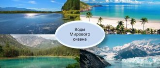
Relaxing at the resort and swimming in the warm sea, it’s hard to imagine that the waters of this sea once visited the Arctic Ocean or washed the icy shores of Antarctica. But this was certainly the case, because the World Ocean is a complex structure consisting of many connecting and branching streams.
Ocean currents have a huge impact on underwater life and on climatic conditions in the coastal zones of continents.
Dynamics of the World Ocean waters. Waves. General provisions
Definition 1
The World Ocean is the main part of the hydrosphere, characterized by characteristics of temperature, salt and biological composition.
One of the fundamental characteristics of the World Ocean, as part of the hydrosphere, is the continuous movement and mixing of waters.
The movement of water masses occurs not only on the surface of the World Ocean, but also in its depths, down to the bottom layers. The dynamics of water are observed throughout its entire thickness, both horizontally and vertically. These processes support regular mixing of water masses, redistribution of heat, gases and salts, which ensures the constancy of the chemical, salt, temperature and gas compositions. The forms of movement (dynamics) of water masses in the World Ocean include:
- waves and swell;
- waves of a spontaneous nature;
- currents and tides;
- convective currents, etc.
Waves are a phenomenon formed under the influence of external forces of various types (wind, Sun and Moon, earthquakes, etc.) and represent periodic systematic vibrations of water particles. The main reason for the formation of waves on the surface of any water body, which includes the waters of the World Ocean, is wind and wind processes. An insignificant wind speed of the order of $0.2-0.3$ m/s in the process of air friction on the surface of water masses causes a system of slight uniform disturbances called ripples. The ripples appear during one-time gusts of wind and instantly fade away in the absence of the influence of wind processes. If the wind speed is $1$ m/s or more, then in such cases wind waves are formed.
Finished works on a similar topic
- Course work Movement of the waters of the World Ocean 430 rub.
- Abstract Movement of the waters of the World Ocean 250 rub.
- Test work Movement of the waters of the World Ocean 190 rub.
Receive completed work or specialist advice on your educational project Find out the cost
The formation of disturbances in the waters of the World Ocean can be caused not only by the influence of wind processes, but also by a sharp change in atmospheric pressure, tidal forces (tidal waves), natural processes - earthquakes, volcanic eruptions (seismic waves - tsunamis). Ships, yachts, ferries, boats and other shipping engineering structures, in the course of their direct activities, when cutting the surface of the water mirror, create special waves called ship waves.
Waves that are formed solely under the influence of external forces that cause them are forced. Waves that continue to exist for a certain amount of time after the force causing them has ceased to act are called free. The waves that are formed on the surface of the water surface, as well as in the uppermost layer of the water masses of the World Ocean (up to $200$m) are superficial.
Waves that occur in the deeper parts of the oceans and are not visually noticeable on the surface of the water are called internal waves.
The strength and size of wind waves directly depend on the wind speed, the time component of its impact on the surface of the water surface, as well as the size and depth of the space of water masses covered by wind processes. The height of the waves, from the base to its crest, is usually no more than $5$ meters; waves with a height of $7$ to $12$ meters or more are much less common. The largest wind waves in size and strength are formed in the southern hemisphere of the Earth, this is explained by the fact that in this part the ocean is continuous, there are no large land areas in the form of continents or islands, and the height of the waves is influenced by strong and constant westerly winds. Waves in this region of the World Ocean can reach $25$ meters in height, and their length can be hundreds of meters. There are much smaller waves in open and especially inland seas than in the open ocean. For example, in the Black Sea the maximum recorded wave height is $12$ meters, in the Sea of Azov these figures are an order of magnitude lower – $4$ meters.
At the moment when wind activity stops in the ocean, long gentle waves are formed - swell. Swell is the most ideal and undistorted waveform. Since the swell is essentially a free wave, this wave travels much faster compared to other waves. The length of such a wave in a swell state can be up to several hundred meters, and taking into account their low height, swell wave processes in the World Ocean, especially in its open areas, are practically invisible.
However, since waves propagate at a significant speed, they tend to hit the coastal part of the land several hundred and even thousands of kilometers from the place of their initial formation. The movement of water masses actively fades with depth. At a depth equal to the wavelength, the waves practically stop.
Since the length of wind waves in many cases is not significant, even with the most active waves, at a depth of $50$ meters and deeper, these waves are practically not noticeable. Thus, the strength of the waves directly depends on its height, length and width of the crest. But the main role still belongs to its height.
Due to the instability of the aquatic environment and regular dynamics and mixing, the layers of the water masses of the World Ocean have varying degrees of density, viscosity, speed of movement, and salt composition. The most striking example is the areas of the World Ocean where phenomena such as the melting of glaciers and icebergs occur, in places of intense precipitation and at the mouths of deep rivers. In this case, the waters of the World Ocean are covered with a layer of fresh water, creating the necessary conditions for the formation of the so-called internal wave passing on the surface of the watershed of fresh and salty water masses.
Note 1
Based on oceanological studies, it was found that internal waves in the open World Ocean occur at the same frequency as surface waves. Quite often, the main mechanisms for the formation of internal waves are processes of changes in atmospheric pressure, wind speed, earthquakes, tidal forces and other factors. Internal waves are characterized by a significant amplitude, but not a high propagation speed. The height of internal waves usually reaches $20–30$ m, but can reach up to $200$ meters. Waves of this height are characterized as a rare and intermittent phenomenon, but still occur, for example, in Southern Europe in the area of the Strait of Gibraltar.