It often happens that parents reduce their preschooler’s acquaintance with geography to only studying maps, memorizing state capitals and memorizing flags. But geography is very vast, has many sections and touches almost every aspect of our lives. This is not only a geographical map...
The concept of geography also includes meteorology, ethnography, geology, ecology, local history, geodesy, geophysics, tectonics and many other related sciences. And this is perhaps the most interesting area of knowledge for a child. After all, any little person is very interested in the structure of the world around him. He is concerned about travel and distant countries, the people and animals that live there. He asks many questions about why earthquakes happen and volcanoes erupt, why the sea always rolls waves onto the shore and why the water in it is salty, what is located underground and at the bottom of the ocean...
Our home is Earth
The baby's first ideas about himself and the world around him are usually very fragmented and unsystematic. Our task as parents is to help the baby realize that every person (including the baby himself) is part of this world. Where to start? First of all, introduce your baby to our amazing planet. Your story might sound something like this: “Every person has his own home. You have it too. You live in it with mom and dad. But all, all people have one more big common home - our beautiful planet Earth. The sky is like a huge blue ceiling, and the ground we walk on is the floor. One big sun shines for everyone. The rain pours on us, like a shower, and the breeze blows across us. A long time ago, many, many years ago, people knew nothing at all about our planet. They thought that the Earth was like a big pancake and lay on the backs of three whales or three elephants, which stood on a giant turtle. When animals began to move, earthquakes occurred on Earth.” Together with your child, you can draw these elephants, and the turtle, and the Earth on their backs and laugh together, because anyone, even the smallest child, knows very well that the Earth is not a pancake, but a huge ball. Of course, a globe will be very useful to you. After all, only with its help will the baby be able to at least slightly imagine what our planet really looks like. Perhaps this is how astronauts from deep space see it. This one is as tiny as a ball.
Ancient people once decided to swim to the ends of the earth. They boarded the ship and after many days of sailing they returned home again, but from the other side. This is how people learned that the Earth is round. Find the point where you live on the map with your baby. Let the baby place his finger on it and, like ancient travelers, move with his finger straight across the globe, without turning anywhere. Came back home"?
Where did our food come from?
It turns out that the products we are familiar with come from the most distant places. The cucumbers that we are so accustomed to and grow in our dachas originated from wild plants in distant India, and apples once upon a time grew only in Central Asia. And to eat fried potatoes, several hundred years ago you would have had to sail to South America. We invite the whole family to play the game “Where did our food come from?”
You will need:
- laminated world map
- paper tape and scissors
- clay to make a dice
- felt-tip pen or circle stickers (I used self-adhesive round furniture pads)
- cards with drawn dishes
- various foods (tomato, cucumber, tea, chocolate, sugar, flour, sunflower oil, vanilla, cinnamon, apple, lemon, onion)
The goal of the game is to collect all the necessary ingredients from different parts of the world to prepare a particular dish and return home. You can decide for yourself what dishes to “cook”. In our game we had three food cards, one for each participant:
- tea with lemon and chocolate;
- Apple strudel;
- salad of tomatoes, cucumbers, onions and sunflower oil.
- Draw and label on the cards the dishes that will participate in the game.
- Take a world map and spread it on the floor. Use paper tape to mark the routes the players will take to get food (the paper tape will easily peel off the laminated surface after the game).
- Tea - from China
- Wheat - from Iran
- Sugar - from India and Southeast Asia
- Chocolate - from the Gulf Coast
- Tomato - from Peru in South America
- Cucumber - from India
- Sunflower oil - from North America
- Lemon - from India
- Apple - from Central Asia
- Vanilla - from Mexico
- Cinnamon - from China
- Onions - from Central Asia
If you want, come up with other dishes and bring rice from China, pasta from Italy, bananas from Malaysia, olives from Greece, pomegranate from Tunisia, oranges from Southern China, pears from the Caucasus mountains, etc.
By the way, in the popular audio encyclopedia with Chevostik and Uncle Kuzya there is an entire audiobook about the history of various vegetables and fruits - “Plant Travel”. (Olga Zhakhovskaya, Natalya Manushkina. Travels of plants. M.: Children's publishing house "Elena", 2005.)
- Make divisions on the routes by sticking or drawing circles on paper tape.
- To play you will need a dice. Make it out of clay and draw on the edges: 1, 2 and 3 dots to indicate the number of moves, a crossed out zero, an airplane and a teapot.
- If a crossed out zero is rolled, the player misses his turn.
- If the plane falls out, the player is instantly transported to any point he needs.
- If the kettle falls out, the player returns to the start, since he forgot to turn off the kettle at home.
- When the clay is dry, the cube can be painted and coated with clear nail polish.
- If you want, place real food on the map before the game starts. Another option is to draw cards. In any case, the child should be able to see where what food is.
- At the beginning of the game, each player draws a card with a dish for which he will collect ingredients. Each participant takes turns rolling the dice and walking. Select your city as a starting point, and you need to return there when all the ingredients have been collected. If your child is still having a hard time with competitive games, then collect ingredients together for the same dish. For example, you can split up: let one go for tomatoes and sunflower oil, and the other travels for cucumbers and onions. And then at the end of the game, when you return home, you will combine the extracted ingredients and you will get a vegetable salad.
- At the end of the game, you can actually cook this or that dish with your child.
Where does Carlson live?
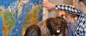
The sooner a geographical map appears in the baby's room, the better. Don’t think that your baby won’t understand or remember anything. It is enough just to draw the young geographer’s attention to the map from time to time, show and name geographical objects, and very soon the child will know parts of the world, oceans, and even many countries with their capitals.
And diverse children's literature is a real treasury of geographical knowledge. And the more we read to the baby, the broader his ideas about the world around him will be. And not just read, but definitely look on the map for the places where events take place. For such games, it is most convenient if the card hangs directly above the child's bed. So, reading about Carlson’s antics, let’s find the country of Sweden and remember its capital - Stockholm. Getting acquainted with the book about the onion boy Cipollino, we will find on the map his homeland - Italy. We’ll also find out where the mischievous Pippi visited during her sea voyages with her captain dad. Especially good is a children's map of the world with all sorts of biological, historical and fairy-tale object-icons. Kids love to look at them, at the same time memorizing a lot of useful information. But an ordinary physical map of the world or a map of the hemispheres will also work. And it’s easy to make a “developmental” card yourself from the most ordinary one. You can paste stickers and pictures with animals and fairy-tale characters onto images of continents. For example, we will place a sticker with the characters of the cartoon “Madagascar” near the island of the same name. And at the same time, we’ll find something interesting in the encyclopedia and read something interesting about this island with our kids. And let's not forget to follow the path of Marty the zebra and her friends from New York to Madagascar. If you find old magazines or atlases from which you can cut out flags of different states, stick them on the map along with the crumbs. Such games will bring undoubted benefits to the baby and will greatly facilitate further schooling.
Kipling's tales will perfectly acquaint the little geographer with the animal world of India. Let the baby remember the location on the map of this country. Travel across the map with Doctor Aibolit, who went to Africa to treat sick monkeys, and with Nils and a flock of geese. When the baby grows up a little, read him a fairy tale about the adventures of Captain Vrungel. It is simply replete with all sorts of geographical details. Of course, don’t forget to find on the map all the places where the brave captain visited on his famous yacht “Trouble”. Better yet, mark his path with a pencil directly on the map. In general, make it a rule to refer to the map in all cases when in everyday life we are talking about some geographical names, be it reading books, watching cartoons, or telling stories to friends who have returned from a trip. This will help the baby remember a lot of useful information and teach him how to use the map. And all this is practically effortless, as if by itself.
World map for children
Hello, dear readers! Parents often wonder whether it is necessary to teach a small child geography, whether it is worth filling his head with complex names or leaving it to school teachers. Of course, there is no need to tell your child about climate zones, terrain and azimuths. But it is advisable to provide initial geographical information in the form of exciting games. And a world map for children will help you with this.
How many cards do you need?
Not every parent can draw a map of the world on their own. Therefore, you should not create difficulties out of the blue: a map of any size can be purchased at a bookstore.
Buy not a political, but a physical map, on which mountains, forests, deserts, etc. are highlighted in different colors. Please ensure that the colors are bright enough and the printing is of high quality.
We recommend purchasing three copies of the card at once.
- You will hang the first one on the wall in the children's room, and the baby will visually get acquainted with the outlines of continents, oceans, and examine mountains and deserts.
- The second card, as large as possible, will be spread on the floor. It is along this route that you and your little one will make exciting and educational journeys. It is advisable that the card sheet be laminated.
- The third card - it can be much smaller than the first two - needs to be glued onto thick cardboard and cut into several parts. These will be your child's first geographic puzzles.
In addition to world maps, you can purchase a globe and several outline maps that your child can color.
Let's start getting acquainted
So, the card was purchased and mounted on the wall in the baby’s room. And the little one stands in front of her with his eyes wide open.
- It's best to start with a story about the continents. Show each of them on the map and name it. Geographic verses can help you:
We divide the world into six pieces: There are six continents in the world. Once - Australia is with us. A kangaroo will meet you there.
This is America, look. South and north. Two and three. Northern, Southern, Very necessary in the world.
And four are Antarctica. Open to the winds and cold. There is only snow and ice floes all around, And penguins sleep on the ice floes.
Then we remember - Five. We need to name Africa. Bananas grow in Africa, and monkeys live there.
And let's call the last one: Six - Eurasia, our home. Most of all, my friends, I am happy that I live here.
- Show your child our country on the map, tell him how big and beautiful it is. “The most important city in Russia is called Moscow,” find it together on the map.
- Tell your child about the oceans that wash continents, seas, and rivers. Explain that water bodies are depicted in blue or light blue. The kid will love the story about the “colored” seas - White, Red, Yellow, Black. Show them to your little one on the world map.
- Further, it should be said that mountains are painted in brown, plains and forests - green, deserts - yellow. Let the child find the largest spots of these colors on the map, and you tell them what they are called.
- You can finish your first introduction to geography by showing the globe. Tell your little one that our Earth is round and this is exactly how astronauts see it from space. But in ancient times, people thought that the Earth was flat and supported by elephants, which, in turn, stood on a large turtle. Show your child the corresponding pictures in the encyclopedia or on the computer.
Traveling across continents
Offer your child a long-term interesting game - you will take turns “travelling” to each of the continents. We will tell you how to do this using the example of Africa.
- Print out a separate map of Africa and hang it on the wall. Tell your child about this continent, read the poem:
What kind of Africa is a country, Where there is only summer and spring, Where there is heat all around - It’s time to find out everything about it. What kind of animals live there, What kind of birds sing there, It’s full of mysteries, What kind of country is Africa?
- Tell your child about the animals and birds that live in Africa. Print out small cards with images of a rhinoceros, crocodile, hippopotamus, giraffe and others and attach them to a map of the mainland with your child.
- To consolidate your knowledge, offer to guess riddles about these animals - for example, these:
We live in southern countries and love all bananas. And we can’t live without them, We are... (monkeys).
He is tall, like a faucet, This is the truth, not a hoax! He is familiar to everyone in the savannah - He eats trees with his tongue. (Giraffe)
He blows like a steam locomotive and has a tail between his eyes. It's gray and huge. Did you guess it? This is an elephant).
- Remember in which children's works Africa is mentioned? “Doctor Aibolit”, “Barmaley” by K. Chukovsky. What geographical names are used there? Limpopo, Nile, Sahara and others. Find and mark them on the map.
- Tell your child about some of the nationalities that inhabit the African continent, support the story with pictures or video material.
- Ask your little one to draw pictures about Africa and hang them on the wall next to the mainland.
- Play “tasty Africa” - for example, sprinkle breadcrumbs on your baby’s porridge and tell him that this is the Sahara Desert. Make Mount Kilimanjaro out of mashed potatoes, bake chocolate “African” cookies, make a dessert out of bananas, etc.
- Watch cartoons about Africa: “Katerok” with the song “Chunga-Changa”, “Boniface’s Vacation”, “Kitten from Lizyukov Street” and others.
- When your child gets comfortable on the African continent, show him the largest countries, tell him about their culture and way of life. Older children can learn the names of the main cities and remember the flags of some states.
“Travel” to other continents in the same way. You will see that literally in a short period of time the little one will become familiar with geographical terms and names and will surprise everyone with his knowledge.
Games with a geographical map
In addition to getting to know the continents, you can play very interesting games using the world map.
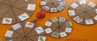
Geographical classics
Spread a large laminated map of the world on the floor and draw it into squares with a felt-tip pen (marks of a felt-tip pen will be easy to remove from a smooth surface).
Let the baby jump from square to square, and you will name which geographical objects he steps on.
At the end of the game, the little one can “walk” along the equator.
Adventure games on the world map
Based on the world map, you can make a unique adventure game. Draw a route with a marker (by the way, it may coincide with the route followed by Columbus, Magellan or other travelers), draw stopping points.
Think over a system of moves - for example, if the stop is on a volcano, then you need to skip 2 moves, if on a river, then move 3 steps forward, etc.
Take a cube, place the chips and travel with the whole family.
Find and show
This game is for older preschoolers who are already well versed in the world map.
Give your child a pointer and call out different geographical names - for example, India, Paris, Yenisei, Australia, etc.
The child must find the object on the map and point with a pointer. For schoolchildren, you can complicate the task by offering not only to show, but also to tell a little about the found city, river or country.
Guess what it is
Start describing this or that geographical object, the child must guess what we are talking about.
For example:
- The country on the map is very similar to a shoe, it has a warm climate, and the favorite dish of the inhabitants is pasta (Italy).
- The island is located near Africa, its name is mentioned in the famous cartoon (Madagascar).
Delicious world map
Prepare pictures with different products (can be replaced with real ones), spread a map of the world on the floor and arrange the products in the place from where they come to your table.
Pasta - Italy, olives - Greece, tea - China or India, coffee - Brazil, bananas - Ecuador, potatoes - Belarus, etc.
While learning geography in a playful way, the child:
- Increases your intellectual level.
- Gets acquainted with the culture, way of life, and customs of different countries.
- Replenishes vocabulary, improves conversational speech.
- Develops fantasy, imagination, logical thinking.
And who knows - maybe your little one, having received his first geographical knowledge by crawling on a world map laid out on the floor, will become a famous traveler and discoverer.
Good luck, baby! See you again!
In the footsteps of Cecile Lupan
Many interesting geographical ideas can be gleaned from the book Believe in Your Child by Cecile Lupan. First of all, these are songs with the names of state capitals. You can tell your baby rhymes or sing songs that mention geographical names. After all, in poetry such information is remembered much easier. Here are some examples:
We soar over Italy, We see the eternal city of Rome. And in Spain - Madrid stands in the center of the entire country. Here in France, in Paris, the Tower of all buildings is taller! And in Britain, without a doubt, London is the most important city.
It would be great to read with your child A. Usachev’s wonderful book “My First Geographical Discoveries”, where geography is studied in poetry and is very fun:
There are many islands in the world, So many that you can’t count them... But we can count six large continents: Africa, America (North and South), Australia, Eurasia, Antarctica (Blizzard). What is Eurasia? This is Europe plus Asia: The largest continent arose from two parts of the world!
Geography in elementary school
Geography, although it appears in the curriculum from grades 5-6, is studied in elementary school as the subject “The World Around Us” or “The World Around Us.” Success in teaching children largely depends on how interesting and educational information is presented in the lessons. It is best to consolidate children's knowledge about the world around them in elementary school in a playful way, so teachers show imagination, resourcefulness, and come up with various games and quizzes.
However, not only the teacher should teach the child geography. Parents should help the student consolidate knowledge, organize it, and understand what he does not understand. Here are some ideas to make learning geography fun.
Colored seas
Your little one probably already knows that rivers, lakes, seas and oceans are indicated in blue on the map. You can start getting acquainted with the planet’s water resources with the “colored” seas. The kid will be interested to know that on our planet there is a Black, Red, White and even a Yellow Sea. Find them on the map and try together to figure out why these seas have such unusual names. The Yellow Sea has a yellowish tint. The Red Sea is home to special algae. During periods of their intensive growth, it seems that the blue water surface is painted in red-brown tones. The White North Sea really has a very light, almost white color of water. And the Black Sea has long been nicknamed this because of the restless nature and black color of the water during storms and storms.
Or maybe the baby will want to draw these colored seas? What countries are they located near? What kind of people live there? Perhaps your baby has already visited one of these seas (for example, the Black or Red) or you are about to go on a trip. Then he will be doubly interested in learning more about these amazing seas.
And then find it on the map and look at other seas. And also try to understand the origin of their names. This will not only expand the child’s geographical knowledge, but also train his thinking, ingenuity and imagination. After all, you can put forward fantastic versions. And then, together with your mother, find information in a children's encyclopedia or on the Internet and check your guesses. After all, why the Mediterranean Sea was called that way, the child will probably guess for himself. You just need to look carefully at the map. The Sea of Japan and South China Sea, for example, will not cause any difficulties. But you will have to think about the origin of the name of the Dead Sea.
Geography on a walk
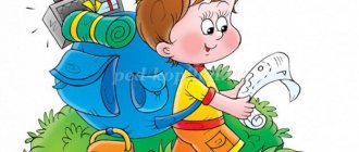
Where is the best place to study Earth Science? On a walk, of course. Better yet, organize a real scientific expedition with your baby. To do this, it is not at all necessary to go on a multi-day hike. Just on one sunny fine day, tell your child that today you are not just going for a walk. You are going on a journey. What do you need for a real trip? Comfortable clothes and shoes, a backpack and, of course, something tasty to refresh yourself at the rest stop. Ready? Then let's go!
It doesn’t really matter where you go with your young traveler: to the forest, park, to the river or to the pond. Just draw his attention to the world around him and tell, tell, tell. For example, about soil. What is black soil, how is it formed and what plants grow on it. Use a stick to rake the pine needles in the pine forest, and let the child see with his own eyes that pine trees grow on sand. What is sand anyway? What about clay, granite, marble?
Be sure to take a compass with you on your mini-hike. Such a wonderful attribute will give the trip special significance. In addition, this is an excellent opportunity to introduce your child to parts of the world and tell them about the wonderful guiding arrow. Probably the baby already knows that in the morning the sun rises into the sky in the east, and in the evening it sets on the other side - in the west. Could the sun mess up something and rise in the west? Of course not. After all, the Earth rotates only in one direction. By the way, have you watched the sunrise and sunset with your child? Does he already know what the horizon line is?
Teach your child to use a compass. Let him hold the compass in his hands and slowly rotate around himself until the red arrow points to the letter N (north). Explain to your child that he is now facing north. Behind him is the south, on the left is the west, on the right is the east. Let the baby determine along the way in which direction you are moving.
You can play the game “I know 5 names...” right on the go. Mom asks the topic: “I know 5 cities...”. And the kid continues, listing the names of cities known to him at each step: “Moscow - one, Kyiv - two...”. Topics can be very different: countries, capitals, seas, rivers, lakes, peaks, volcanoes. Or even like this: “I know 5 animals living in North America...” If 5 names are easy to remember, we name 10 at once. Mom prompts, the baby remembers. This is how we expand our geographical knowledge.
During a walk in the forest, bury a “treasure” in a secluded place - a tightly screwed glass jar with children’s “treasures”. Draw a map of the place where your treasure is buried, using symbols. Usually children are delighted with such games. Save your map carefully and during your next walk try to find the cache using it as your guide. Come up with your own designations for deciduous and coniferous trees, bushes, stumps, large stones, ravine, lake, spring, rivulet. And then, already at home, look with your child at how the same objects are indicated on real maps. The game can be continued endlessly, drawing a map of a room, apartment, yard, street, and even made-up maps of imaginary countries and islands. Such games not only expand geographical knowledge, but also train the spatial thinking of the young cartographer and treasure hunter.
When talking with your child about such difficult things as the structure of the Earth, take into account the child’s ability to understand everything literally. One day, during a walk, a five-year-old daughter thoughtfully examined a crane visible from behind the fence of a construction site. The crane was lifting concrete slabs. “Are those slabs in the ground the same as these?” I didn’t immediately understand what it was about. What slabs are in the ground? “Well, those that collide with each other and create an earthquake.” These are the times! Having once read in a children's encyclopedia that earthquakes occur from the collision of large masses of earth (plates), my daughter decided that these were concrete building slabs lying in the ground and colliding from time to time, apparently out of boredom. She just hadn’t seen any other slabs in her life and couldn’t imagine what it was. So, when explaining such complex things to kids, try to find out from them how they understood your (or book) explanation. Otherwise, confusion in children's heads cannot be avoided.
About education
Finally, I would like to talk about schools in different countries of the world. Interesting facts can sometimes even shock you. For example, students in educational institutions located in Papua New Guinea do not have to wear clothes.
In some Indian towns, the situation with education is so sad that schoolchildren are taught... by children just like them. There is such a school in the city of Murshidad. The teachers there are taught by children who acquired their knowledge from outside. In general, in India, parents are very worried about the success of their children. So if a tourist sees people climbing on window bars, you shouldn’t be surprised - these are adults trying to tell their children the correct answers to exam questions so that they pass everything successfully. It is prestigious to get an education here.
In different countries of the world, interesting facts characterize this or that state in their own way. The economic situation in Indonesia is very sad - everyone knows this. In the village of Levak, for example, there is only one school, and to get to it, you need to overcome a dangerous suspension bridge, which at any moment can fall into the river.
In some settlements in the Philippines, children get to school by crossing bodies of water in inflatable boats. And in Colombia, students cross the Rio Negro River, sliding down a 400-meter cable to the opposite side of the bank, since there is a school there.
However, there are still many interesting facts about the states of our world, and if you wish, you can familiarize yourself with them. Because it’s very difficult to list everything.
Expeditions with Winnie the Pooh
For kids with their developed imagination and wild imagination, any event that seems insignificant in our opinion can become a geographical adventure. Remember how Christopher Robin, along with his friends Winnie the Pooh, Piglet, Donkey and Rabbit, went on an expedition to find and discover the North Pole?
Our entire expedition wandered through the forest all day. The expedition was looking everywhere for the way to the Pole...
But you too can go in search of the pole. And not only the North, but also the South too. Just first show your child these poles on the globe and tell him about the earth's axis - an invented line that seems to pierce the Earth right through. Those points through which our imaginary axis passes are called poles. The upper pole is called the North Pole, and the lower pole is called the South Pole. The poles receive the least amount of solar heat, which is why the coldest places on our planet are located here. Of course, the search for the pole will be imaginary, and no earthly axis actually exists. But while walking, you can discuss many important and interesting things: what is called the Arctic and what is the Antarctic, which animal lives at which pole, what is the polar day and polar night, what are winter and summer like at the poles, what are icebergs, what are they for? icebreakers are needed to study polar expeditions and much more.
And next time you can go in search of the equator. And, of course, talk about the fact that the equator is also an invented line. It’s as if it surrounds our Earth with a belt in the middle. This is where the sun's rays get the most, which means it's always hot at the equator. There is no winter here. Let's remember the hot equatorial countries and their inhabitants, sandy deserts and dense jungles, tropical rains and drought, and of course the amazing animals that live here.
Minerals
Our land contains many real riches and treasures. And this is also an interesting and important topic for discussion with your child. Why are natural resources called “minerals”? Fossils - because these riches need to be sought and dug out of the ground, and useful ones - because they bring great benefits to people. While preparing dinner with your little one, tell him about natural gas. But in the kitchen there is another valuable “fossil” - salt. Ceramic dishes are made from clay, glass from sand. All these are minerals.
Sitting by a fire in the forest, think about coal; when traveling in a car, think about oil. Walking around the city will introduce your baby to rocks such as marble and granite. They are widely used in construction. While doing creative work with your little one, tell them that earthly riches even help them make wonderful drawings. Multi-colored crayons for drawing on asphalt are a type of chalk rock. It was made from shells and parts of tiny plants and animals that lived many, many years ago. And the lead of a pencil, which leaves colored lines on paper, is made from a mineral called graphite.
Rings and beads are made of precious stones. These stones are very beautiful. They shine and shimmer in different colors. Such stones are rare in the ground and are expensive, which is why they are called precious. These are diamonds, rubies, emeralds, etc.
Try creating your own collection of minerals with your child. Most likely, you will not be able to find precious stones, but ordinary salt, coal, sand, chalk, graphite, etc. will rightfully take their rightful place in it.