Lesson topic:
Great Britain
The purpose of the lesson:
- Educational:
Identify general information and characterize the geographical features of Great Britain as a highly developed state, one of the leading world powers;
2. Developmental:
Continue to develop creative abilities, develop the ability to extract the necessary information, be able to analyze cartographic materials and give a brief description of the areas of specialization..
3. Educational:
To contribute to the education on this material of a moral and aesthetic perception of the country, the formation of a universal worldview. Continue work on nurturing international and tolerant qualities in schoolchildren;
The main task:
Give a complete description of the country, and at the end of the lesson try
create an information map of this country.
Equipment:
Physical, political, comprehensive maps of Great Britain; presentation
Methods:
Combined lesson with elements of vitagen teaching technology
Educational and methodological support:
- Yu.N. Gladky, V.V. Nikolina. Geography. Modern world. 10 -11th grade. M.: “Enlightenment” - 2011
- Atlas. Economic and social geography of the world. 10 -11th grade. Federal State Unitary Enterprise “Novosibirsk Cartographic Factory”, 2007
- Yu.N. Gladky, V.V. Nikolina. Geography. My trainer. 10-11 grade. M.: “Enlightenment” - 2012
- Outline maps grade 10. AST-PRESS 2011
Educational and visual complex:
- Laptop, screen.
- Geographic maps: Political map of the world, map of Great Britain, atlases
Lesson time:
45 minutes
Author's media product:
- Type of media product – Visual presentation
- Feasibility of using a media product
– increasing the efficiency of learning the material; development of students' creative abilities; intensification of the educational process.
During the classes
I. Organizational moment.
II. Learning new material. Presentation
- Activating students during the lesson
- Guys, let's sit quietly and listen (listen to the clock ticking).
What does the clock count? Hear how quickly time passes, one might say, it runs and even rolls! And, moving in a circle, the clock hands began to count down the time of our lesson. We smiled at each other and wished each other good luck.
— “Walking through a shady grove, the Egyptian priest talked with his
student. “Tell me,” asked the young man, “Why are you often overcome by doubts? You have lived a long life and are wise with experience. How is it that so many unclear questions remain for you?”
In thought, the priest drew two circles in front of him with his staff: a small one and
big. (Two circles are drawn on the board: small and large).
“Your knowledge is a small circle, and mine is a large one. But all that remains outside the circles is the unknown. A small circle has little contact with the unknown. The larger the circle of knowledge, the greater its border with the unknown. And henceforth, the more you learn new things, the more unclear questions you will have.”
Today we will learn new things and you may have questions. I think we will find answers to them together.
The British anthem plays. (Nadia sings)
- Guys, I have a question for you. -Which country will we study today?
That's right, Great Britain.
Let's together determine the purpose of our lesson. Why do we need to study this topic?
The name of the country comes from the English Great Britain. Britain - according to the ethnonym of the Briton tribe.
The full name in English, who can translate it, is the United Kingdom
of Great Britain and Northern Ireland.
A country of amazing beauty, with a rich history and centuries-old traditions. Home to many prominent figures and an internationally recognized tourist destination. This includes the royal family, distinctive culture and customs, ancient architectural landmarks, haunted family castles, chapels and cathedrals, ancient universities, vibrant cities and quaint villages that have not changed over the centuries .
2. Learning new material
The characteristics of any country are given according to the plan. And our first point is general information about the country.
GREAT BRITAIN is a state in northwestern Europe, on the British Isles (the largest is the island of Great Britain), the northeastern part of the island of Ireland, the Isle of Man, the Isle of Wight, the Channel Islands and other small islands. Separated from the continent by the English Channel and Pas de Calais.
Consists of 4 administrative and political parts (historical national regions): England (39 counties, 6 metropolitan counties and a special administrative unit - Greater London), Wales (8 counties), Scotland (12 regions: 9 districts and 3 island territories) and Northern Ireland (26 counties).
The Isle of Man and the Channel Islands are independent administrative units.
In terms of territory, the UK ranks 77th in the world.
Area 244820 km2.
Population 63,181,775 (2011).
Capital London.
Large cities and agglomerations: Greater London, Birmingham, Leeds, Glasgow, Sheffield, Bradford, Liverpool, Edinburgh, Manchester, Bristol.
The official language is English.
The monetary unit is the pound sterling.
- Great Britain is a constitutional monarchy (but there is no formal constitution; there are a number of basic legislative acts). The head of state is the queen. Legislative power is exercised by the Queen and a bicameral parliament (House of Lords and House of Commons). The executive branch is headed by the prime minister, the leader of the party that received the majority of votes in the elections to the House of Commons and forms the government. David Cameron. Great Britain heads the Commonwealth (including 53 countries (its former dominions and colonies)
Great Britain has an amazing history - originally inhabited by Celtic tribes, it went from a remote Roman province to the powerful British Empire, shrinking in the mid-twentieth century almost to its original size, without losing either its influence on the world stage or the respect of the world community.
2.Message from Kolomiytsev Artyom and Burmistrova Nadezhda
The state is located on the British Isles (the island of Great Britain and the north-eastern part of the island of Ireland, a large number of small islands and archipelagos, including the Hebrides, Orkney and Shetland Islands, Anglesey, Arran, White), washed by the Atlantic Ocean and its seas - the North and Irish, the English Channel, Pas de Calais, North and St. George straits. The coastline is heavily dissected by bays (fjords in the north and estuaries in the south), forming large peninsulas of Wales and Cornwall. Area: total - 243,809 km², land - 240,579 km², inland waters - 3,230 km². The highest peak is Ben Nevis (1343 m) - located in the north of Scotland (Grampian Mountains), the lowest point is Fenland (−4 m).
The southeast coast is located just 35 km from the northern coast of France, which are separated by the English Channel. The southern coast is connected to continental Europe through a 50 km long Eurotunnel (of which 38 km is under water). This is the longest underwater tunnel in the world[10]. Northern Ireland has a 360-kilometer land border with the Republic of Ireland, and this is the only land border of Great Britain. A dense network of deep rivers (Thames, Severn, etc.), many of which are connected by canals, often outdated. There are many lakes in Scotland and Ireland (Loch Ness, Loch Lomond in Scotland, etc., Loch Neagh in Northern Ireland)
Greenwich Observatory in London is the location of the Prime Meridian. In general, Great Britain is located between latitudes 49° and 61° north and between longitudes 9° west and longitude 2° east.
The climate is temperate oceanic, humid, with mild winters and cool summers (influence of the Gulf Stream). Average temperatures in January are 3-7 °C, in July 11-17 °C. Precipitation on the plains is 600-750 mm, in the mountains 1000-3000 mm per year, drizzling rains and fogs are frequent. The western part of the country receives slightly more rainfall than the eastern part.
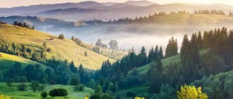
There are also significant geographical differences between the four historical regions. Scotland and Northern England are mountainous and geographically represent High Britain - the North Scottish Highlands (Ben Nevis, 1343 m, the highest point in Great Britain), the South Scottish Highlands, the Pennine and Cambrian Mountains, the Lake District in the north-west of England . The area is characterized by smoothed plateau-like peaks and gentle turfed slopes; in the north, glacial landforms have been preserved. From High Britain, Low is separated by a conventional line that runs in a south-west direction from Newcastle at the mouth of the river. Tyne to Exeter at the mouth of the river. Aix in south Devon. In the south and southeast of Low Britain there are rolling plains (London Basin, etc.), framed by cuesta ridges, a typical landscape of “good old England.”
- Message from Alexander Bezhin.
Great Britain has significant mineral reserves. It is especially rich in coal, the total reserves of which are 189 billion tons. Rich coal deposits are in the Penines, in the mid-Scottish lowlands, in the foothills of southern Wales, the industrial reserves of which are 4 billion tons
In the 60–70s, new large energy resources were discovered on the North Sea shelf - oil and natural gas.
The discovery of oil deposits in the North Sea led to the rapid development of the oil industry. With an average production level of 2.6 million barrels per day, the UK ranks sixth in the world as an oil producer. Oil reserves in Great Britain reach 770 million tons.
Natural gas reserves are estimated at 22.7 trillion cubic feet.
The UK also has significant reserves of iron ore - 4.5 billion tons. The largest deposit of iron ore is in the East Midlands: 60% of all reserves are concentrated here.
Economically important fossil ores include lead, the extraction of which only satisfies half of the economy's needs, and zinc. There are quite a lot of other resources, such as chalk, lime, clay, sand, gypsum.
There are significant reserves of rock and potassium salts.
Lead-zinc and hematite ores were found in the Cambelden massif, and lead-zinc and tin ores were found in Cornwall.
- POPULATION.
In terms of population, the UK is comparable to France and Italy, but noticeably inferior to Germany. The dominant and largest group of the population of Great Britain are the British. About 80% of the population is English, 15% are Scots, Welsh (Welsh), Cornish and Irish; OK. 5% of the population are immigrants from Commonwealth countries. A fairly large group (about 500 thousand people) in the UK are Jews, living mainly in London and other large cities. The population is growing mainly due to labor immigrants from countries that have recently joined the European Union, who, after the EU enlargement in May Since 2004, free entry to work in the UK has been allowed. However, the country's birth rate still exceeds death rates, although natural increase is no longer the dominant factor in the increase in the number of Britons.
Using the “Peoples” map, determine which language family and group the population of Great Britain belongs to.
5.-Evgeniy Troshchenko will introduce us to the country’s economy.
Great Britain is a highly developed industrial country. Over the past 20 years, the following transformations have been carried out in the English economy: the public sector has been reduced; tax rates for individuals and legal entities have been reduced; deregulation of the economy was carried out (with a simultaneous reduction in government spending). In 1995, in terms of total industrial production, Great Britain ranked 5th in the world (after the USA, Japan, Germany, and France). GNP (gross national product) per capita is $24,500 (2000). It ranks first in Europe in terms of energy reserves, being a major producer of oil and gas (production is carried out using the most advanced methods on platforms; the British sector contains about 1/3 of the reliable reserves in Europe) and coal. Oil production was 124 million tons in 1996 (the main fields are Brent and Fortis), gas production was 89.9 billion m3 (17 fields are exploited, the largest are Leman Bank, Brent, Morekham). British Petroleum and the Anglo-Dutch company Royal Dutch/Shell are among the leaders in their market segment. Historically very important coal production is constantly declining.
In the manufacturing industry, priority is given to such sectors as transport engineering (12.4% of total industrial production), including automobile manufacturing (national companies and branches of foreign companies Rover, Ford, Jaguar, Vauxhall, Pegeout-Talbot, Honda, Nissan, Toyota); shipbuilding; the aerospace industry is the third largest in the world after the USA and France, producing civil and military aircraft (British Aerospace, Harrier, Tornado, Eurofighter), Rolls-Royce aircraft engines, equipment for the European concern Airbus Industry; food industry (12.5% of total production); general engineering: production of agricultural machinery and machine tools, including the production of textile machinery (Great Britain is the seventh largest manufacturer of machine tools in the world); electronics and electrical engineering; computers, processors and supercomputers (including manufacturers such as IBM and Compaq); software; telecommunications means (fiber optics, radars, etc.); medical equipment; Appliances. The chemical industry accounts for 11% of total production. These are: pharmaceuticals (Great Britain is the world's fourth largest drug manufacturer); agrochemistry; perfumery; new materials and biotechnologies.
The development of modern industry in Great Britain is determined by the level of development of high technology. Great Britain has the highest scientific and technical potential in Europe. Expenditures on research work amount to over 2% of GDP per year, including over 35% of all research work being financed by the state. Traditionally, textile engineering was important (confined to the old textile regions - Lancashire, Yorkshire). The oldest branch of English industry - textiles - has now lost its former importance (the main areas of production of the cotton industry are Lancashire, wool - Yorkshire, knitting - the East Midlands, linen - Northern Ireland). Large food-flavoring industry (production of food concentrates, confectionery and tobacco products, drinks (about 1/5 of the world export of alcoholic beverages, mainly Scotch whiskey and English gin).
- Agricultural production is highly intensive and meets half of the country's food needs. In 1994, 24.8% of the country's territory is used in agriculture (including over 60% under arable land, 35% under cultivated meadows), pastures occupy 45.9%, and 10.4% under forests. The main branch of agriculture is animal husbandry. It suffered significant damage in the late 1990s. epidemics of mad cows (sponge encephalitis) and foot and mouth disease. OK. 1/3 of the arable land is occupied by cereals, mainly. wheat and barley. The main agricultural regions are East and South-East England.
Great Britain is an island state; all its external transport and trade are associated with sea and air transport. All areas of the UK are directly connected to seaports, which serve as main transport hubs. The UK is connected to the continent by a Channel Tunnel, two railway ferries and numerous sea car and passenger ferries. In domestic transportation, road transport plays the largest role. London and Glasgow have underground trains. There are about 450 civil airports in the country - the largest of them is Heathrow.
Great Britain is one of the most economically developed countries in the world, and it is home to the world's largest financial and trade centers (London, Liverpool, Glasgow), famous scientific centers (London, Oxford, Cambridge, Edinburgh) - hence the great importance of business and congress tourism. Tourists also come to the sporting matches that often take place in Great Britain, especially football matches.
Work in a k/k. Mark the scientific centers of Great Britain on the K/K.
Conclusion :
Now Great Britain is a highly developed state, one of the leading world powers. In terms of industrial production, it ranks fifth in the world after the USA, Japan, Germany and France. But this is not the limit. In Britain, minerals are being mined and new methods of extracting them are being developed. Due to the fact that Britain is an island state, it remains one of the largest maritime powers today.
Thanks to its EGP, the UK still has development options. This country can only develop and improve its position in the world.
I II. Consolidation.
Drawing up an information map of the country. (Work in groups)
I V . Reflection
The ticking of our clock indicates that the lesson has come to an end and I want to know if the lesson was not in vain. Please mark your condition at the end of the lesson with icons on the map.
V. _ Homework.
Paragraph No. 39. Draw up a diagram of the “Structure of the UK Economy”

